The Rise and Muddy End of Leptis Magna
How Roman engineers built a masterpiece to save Leptis Magna – and why their brilliance only delayed the inevitable
First published in tg-channel Cliomechanics in Russian
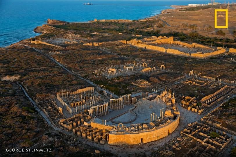
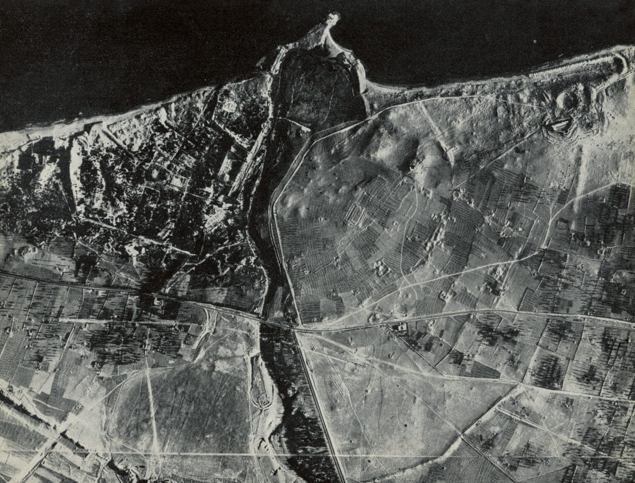
Next to the ruins of Leptis Magna on the coast of Libya, there’s a bush‑covered depression, cut off from the sea by a wide strip of sand and stones. Not far away, hundreds of meters from the current shoreline, you can still find the remains of quays and warehouses. This was once one of the largest harbors in the Roman Empire – and its construction ended up being inseparably linked to the city’s downfall.
The Phoenicians founded Leptis Magna at the turn of the 12th–11th centuries BCE. They chose a perfect natural bay at the mouth of a full‑flowing river, the Lebda, which gave the city fresh water and a route inland. Back then, North Africa’s climate was much milder and wetter than today: the river’s steady flow kept the harbor naturally flushed – no dams or silt channels needed – and there was enough rain for farming. The city thrived for almost 1,300 years, becoming one of the key trading hubs of Carthage and later of Roman Africa.
By the 2nd century CE, the climate began to slowly dry out. The Lebda River started turning into a seasonal stream – a wadi – and human pressure on the landscape grew. Deforestation and farming in the upper reaches of the Wadi Lebda caused serious soil erosion. The river became unpredictable: during droughts it shrank, and after rare storms it dumped enormous amounts of silt into the bay. Leptis Magna was slowly dying – a process that might have dragged on for centuries, if not for a local son. His name was Lucius Septimius Severus.
The emperor made saving his hometown a personal mission. In the late 2nd – early 3rd century CE, Leptis Magna was radically rebuilt, and the heart of the project was a new harbor covering about 100,000 square meters.
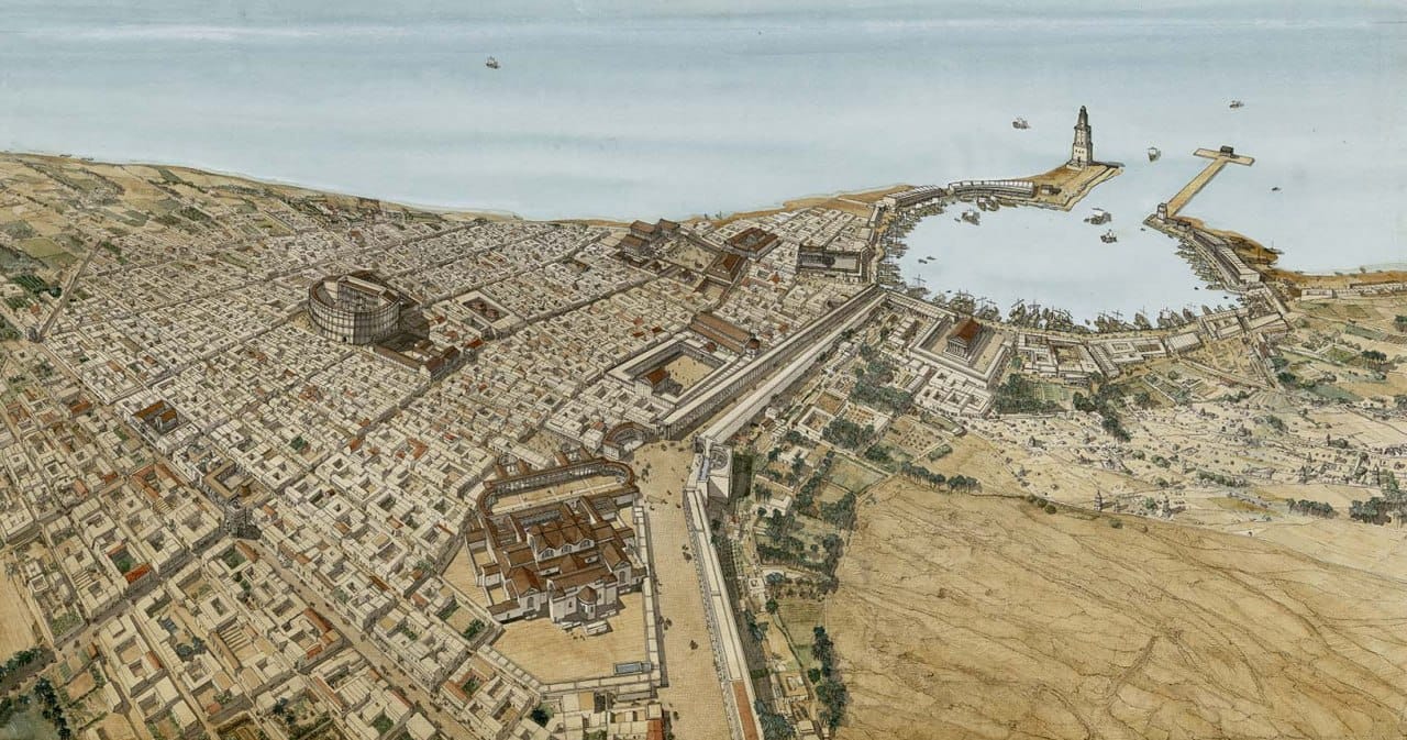
To stop the port from silting up, Roman engineers built a massive hydraulic system: a sturdy dam upstream, and a man‑made channel to divert the wadi’s course away from the city. The idea was to flush floodwaters and sediment into the sea west of the city, bypassing the harbor. It was a masterpiece of engineering – but a very fragile one. The system worked perfectly as long as the authorities kept paying for a maintenance crew. Then, in 365 CE, a powerful tsunami hit the coast. The population dropped, and the ensuing chaos – administrative collapse, Vandal and Berber invasions – finally broke the infrastructure.
Regular cleaning of the bypass channel and dam repairs stopped. At some point, the neglected dam gave way during another African downpour. The Wadi Lebda burst through the barrier and, following its ancient course, sent a massive mudslide – thick with water, gravel and stones – straight through the city and into the harbor. The floods quickly turned the unmaintained deep‑water port into a swamp. The city’s economy, based on exporting grain, olive oil and exotic goods by sea, collapsed. Even though the Romans tried to revive the city in the 6th century, by the time the Arabs arrived in the 7th century, Leptis Magna was largely abandoned – only a garrison remained.
The river deposits from the Wadi Lebda filled the streets and squares with meters of silt, creating an airtight sarcophagus around the ruins, and then the Sahara’s sands buried it all. The full scale of the disaster only became clear with the arrival of aerial photography in the mid‑20th century. The catastrophe had sealed the city – and that’s why Leptis Magna survives today as one of the greatest monuments of antiquity.
Sources:
📚 R. Bartocini. Il porto romano di Leptis Magna.
📚 J.P. Oleson et al. Building for Eternity: The history and Technology of Roman Concrete Engineering in the Sea.
📖 T. Howard Carter. Western Phoenicians at Lepcis Magna.
📖 E. Cirelli, S. Pucci. Environment-Man Relationships In Historical Times: the Balance Between Urban Development and Natural Forces at Leptis Magna.
Comments ()